This Parish Summary is an overview of the large amount of information held for the parish, and only selected examples of sites and finds in each period are given. It has been beyond the scope of the project to carry out detailed research into the historical background, documents, maps or other sources, but we hope that the Parish Summaries will encourage users to refer to the detailed records, and to consult the bibliographical sources referred to below. Feedback and any corrections are welcomed by email to heritage@norfolk.gov.uk
The parish of Burnham Overy is situated on the north Norfolk coast, immediately west of Holkham. Its name comes from the Old English for ‘Homestead by a stream across the river’. The parish has been in existence for a long while, and was certainly well established by the time of the Norman Conquest, its ownership, population and productive resources being listed in the Domesday Book of 1086.
Although there have been several finds of prehistoric flint tools, the earliest properly dateable objects to be found in the parish were two Mesolithic flint axes (NHER 17960). These were, however, the only examples of the period, just as a Neolithic polished flint axehead (NHER 1739) is the only find from that time. A stone axe hammer found in 1933 (NHER 1740) may be Neolithic, but may equally be Early Bronze Age. The Bronze Age is otherwise represented by the single find of part of a copper alloy palstave (NHER 34482).

A Roman dupondius coin, perhaps from Burnham Overy. NWHCM 1938.121.1:A (©NCC)
It is not uncommon for the Iron Age to leave little or no trace of its passing, and in the case of Burnham Overy, so far there are no remains. However, things look up during the period of the Roman occupation. Pottery fragments have been recovered from several sites, (NHER
1730,
14327 and
36007), and some coins have also been found (NHER
12929,
17791 and
13659). Aerial photography has also identified cropmarks of a Roman settlement or farmstead east of Burnham Overy Staithe (NHER
12984), and Roman pottery fragments have been picked up in its vicinity. An Egyptian coin of Ptolemy III found in 1933 (NHER
1749) was probably brought over by a Roman soldier during the occupation.
Middle or Late Saxon sword chape decorated with an animal heads from Burnham Overy. (©NCC)
The Saxon period in the parish is represented by a very important site (NHER
18496). Large quantities of Middle Saxon pottery fragments and high quality continental metalwork recovered from this site, which also covers parts of neighbouring parishes, suggests this may have been the site of an important market. It is also possible that the site was the original focus of settlement in the area, with the present Burnham Market developing from the Late Saxon period.

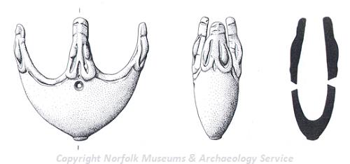
A zoomorphic Late Saxon imported Viking 9th century gilded convex disc brooch decorated with nine animal heads.
(©NCC)
The medieval period following the Norman Conquest has left the parish with its oldest surviving building, St Clement’s church (NHER 1741). Quite unlike any other church in Norfolk, this was originally an 11th century aisleless cruciform building with a central Norman tower. The transepts have now gone, and of the later north and south aisles, only part of the south aisle remains. The tower has been shortened and is now topped with a 17th century cupola. The interior is also curious. After the Reformation, the area beneath the tower was blocked off, the nave being used as the church, and the chancel having various uses, and for a time being the village school. Although the whole building has now been reunited, the nave and chancel are still only linked by a narrow passage through the tower base.
The site of another medieval building is in the south of the parish. Peterstone Priory (NHER 1774) was an Augustinian priory, founded before 1200, and later also used as a hospital. Little of it now remains, though the current farmhouse and barn contain some original walls and doorways, as well as having much reused masonry. The base and a short length of octagonal shaft of a 14th century limestone cross (NHER 1771) have survived, and there is also evidence for medieval pits being used for the temporary storage of shellfish (NHER 35382).

Burnham Overy windmill. (©NCC)
Quite a number of buildings have survived from the post medieval period, including Gun Hill Farmhouse (NHER
9616) which dates to 1680, Rayner’s Row (NHER
20876), which is 17th or 18th century, Ostrich House (with adjacent buildings) (NHER
37368), originally 18th century and for many years a pub, but now residential, and Church House (NHER
39672) and Marsh House Farm (NHER
9615), from the early 19th century. There were also a number of windmills in the parish. Some have gone (NHER
15152 and
15153), but others remain, although now used for different purposes. Burnham Overy windmill (NHER
1765) and water mill (NHER
1766), are now owned by the National Trust, the windmill being a holiday let and the watermill residential. Union Mill (NHER
1772), a water mill of 1737 with an attached miller’s house and an early 19th century windmill is now also residential.
Being on the coast, the parish has in the past been included in defensive strategies at times of conflict. Gun Hill (NHER 1729), a large sand dune, now eroded, was reputed to have been used as an artillery emplacement during the Napoleonic Wars, and overlooking the harbour is a defensible granary (NHER 20875) from the same period, its gunports now blocked.
Gun Hill was again used as a military installation in World War Two, and traces of buildings from then still survive. Other invasion defences from this war still to be seen include two anti-tank mortar bases (NHER 20877 and 36027), and anti tank blocks (NHER 27023, 27024 and 27055). There were also military buildings from the war in the parish, visible on 1945 aerial photographs, but they have since been taken down (NHER 26656).
Various man made sea defences, in the form of earth banks have been recorded in the parish (e.g. NHER 36028, 36037, 27021 and 26669). These are difficult to date, but are thought to be post medieval, and in some cases modern. Also hard to date are shipwrecks, an undated example of which is recorded at (NHER 41476).
Pieter Aldridge (NLA), 1 December 2005.
Further Reading
Brown, P. (ed.), 1984. The Domesday Book: Norfolk (Chichester, Phillimore)
Rye, J., 1991. A Popular Guide to Norfolk Place Names (Dereham, Larks Press)