This Parish Summary is an overview of the large amount of information held for the parish, and only selected examples of sites and finds in each period are given. It has been beyond the scope of the project to carry out detailed research into the historical background, documents, maps or other sources, but we hope that the Parish Summaries will encourage users to refer to the detailed records, and to consult the bibliographical sources referred to below. Feedback and any corrections are welcomed by email to heritage@norfolk.gov.uk
Thurton is a small parish situated some 4.5km southwest of the River Yare, in the Local Government district of South Norfolk. It is 13.5km southeast of Norwich on the A146, and in 2001 had a population of just over 550 people. The name ‘Thurton’ is thought to derive from the Old English for Thorn Enclosure.
The earliest recorded objects are three Neolithic polished axeheads (NHER 10320, 10321 and 10322), two Neolithic flaked axeheads (NHER 16261 and 22976), and a possible Bronze Age copper alloy axehead (NHER 13272).
The earliest recorded monuments are a number of round barrows, a group (NHER 49491) of which can be seen in the west of the parish, and across the border at Burgh Apton. These are thought to represent a Bronze Age round barrow cemetery. Other ring ditches can also be seen closer to the centre of the village (NHER 23743 and 49512).
Only one record of Roman period activity has been recorded, and this is a hoard of Roman copper alloy coins (NHER 10323) which was recovered in 1707. This hoard was thought to have been deposited in the third century, and contained coins minted under the emperors Gallienus, Victorinus, Tetricus and Quintillus.

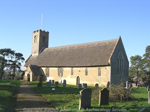
St Ethelbert's Church, Thurton. (© NCC)
No objects have been recovered from the Saxon period, and although Thurton is listed in the Domesday Book of 1086, it is mentioned only briefly and appears to have been only sparsely populated. The earliest standing building is therefore St Ethelbert’s Church (NHER
1665), which has a beautiful Norman south doorway and a smaller, less extravagant Norman north doorway. Other features, such as the windows in the nave and chancel, date to around 1300. Inside a wall painting dating to around 1500, and a number of fragments of stained glass dating to the 15th to 16th centuries, can be seen.
Other medieval sites include the 15 century stone cross (NHER 10326) that stands at the junction of the four parishes Carleton Rode, Chedgrave, Langley with Hardley, as well as Thurton, and depicts the symbols of the four evangelists. A number of cropmarks of medieval to post medieval field boundaries (NHER 49513) have also been recorded, and it is possible that the George and Dragon Public House (NHER 32076) may have evolved from a late medieval hall house. The building itself has a parlour end dating to around 1600, and has a main block dating to the 18th century.

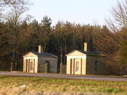
Thurton Lodges to Langley Park. (© NCC)
Other post medieval structures include Thurton Hall (NHER
1664), which is a mid 16th century building with an elaborate staircase and an early 17th century doorway, as well as High House (NHER
45720), a red brick structure of the 17th century and later. Three areas of post medieval field boundaries have also been noted (NHER
49494, NHER
49495, NHER
49513).
A small number of objects from the medieval and post medieval period have also been recorded. These comprise a groat of Edward I (NHER 13273), a medieval lead weight and unidentifiable coin (NHER 31482), as well as a small concentration of medieval and post medieval coins and fittings (NHER 37428).
Ruth Fillery-Travis (NLA), 3 July 2007
Further Reading
Morris, J. (General Editor), 1984. Domesday Book, 33 Norfolk, Part I and Part II (Chichester, Phillimore & Co)
Pevsner, N., 1997. The buildings of England: Norfolk 2: Northwest and South (London, Penguin Books)
Rye, J., 1991. A Popular Guide to Norfolk Place Names (Dereham, The Larks Press)
Wikipedia contributors, 22 June 2007. ‘Thurton’. Available:
http://en.wikipedia.org/w/index.php?title=Thurton&oldid=139925490. Accessed: 3 July 2007.