This Parish Summary is an overview of the large amount of information held for the parish, and only selected examples of sites and finds in each period are given. It has been beyond the scope of the project to carry out detailed research into the historical background, documents, maps or other sources, but we hope that the Parish Summaries will encourage users to refer to the detailed records, and to consult the bibliographical sources referred to below. Feedback and any corrections are welcomed by email to heritage@norfolk.gov.uk
Barwick is a tiny parish in the northwest of Norfolk. It is located south of Stanhoe and northwest of the larger village of Great Bircham. Traditionally pronounced 'barrick' the parish name probably derives from 'barley farm or outlying grange' and is old English in origin suggesting there was settlement here from the Saxon period. In the Domesday Book the area is recorded as being owned by Simon in 1087. Occupation is now focussed at Great and Little Barwick hamlets. Although there are few people living here now there is evidence of much larger settlements during the medieval period, and the archaeological record suggests there was human activity here from the earliest times.

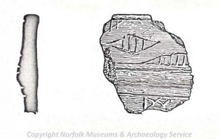
A fragment of a Beaker pottery vessel with incised decoration found in Barwick. (©NCC)
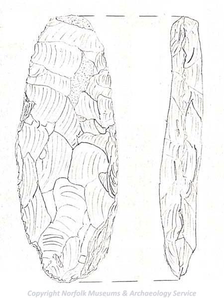
Prehistoric finds include a Neolithic axehead (NHER
1978) and a fragment of a Beaker period pot (NHER
1978). Activity continues into the Roman period. A Roman road runs through the parish (NHER
1922) and several scatters of Roman pottery (NHER 28705 and
32944) and a Roman coin have been found (NHER
32944).

A Neolithic flaked flint axehead found in Barwick. (©NCC)
Metal detecting has recovered evidence of Early to Late Saxon occupation (NHER 28705) including an Early Saxon girdle hanger, a Late Saxon disc brooch and at another site fragments of Late Saxon pottery have been recovered (NHER 32944).
There is ample evidence for occupation here in the medieval period. The hamlet of Great Barwick was once much larger and traces of the deserted medieval village (NHER 1923) are recorded on the Ordnance Survey map as earthworks. The church of Great Barwick (NHER 1925) may date to around the 12th century but it is now in ruins and is only visible as earthworks. The smaller village of Little Barwick has also been deserted. The site is recorded as the deserted medieval village of Little Barwick or Middleton (NHER 1924). This medieval settlement had no church. It had vanished by around the late 14th or early 15th century. Other evidence for medieval activity includes scatters of medieval pottery (NHER 32949) that may have been spread by manuring of the fields where traces of undated but probably medieval or post medieval ridge and furrow can be seen (NHER 1926).
In the post medieval period Barwick House (NHER 20953), an 18th century great house designed by R. Glover was built, possibly on the site of an earlier manor house. There are also signs of Little Barwick parkland (NHER 30494) that was landscaped in the late 18th century and includes a ha ha.
Megan Dennis (NLA), 15th August 2005.
Further Reading
Brown, P. (ed.), 1984. Domesday Book, 33 Norfolk, Part I and Part II (Chichester: Philimore)
Mills, A.D., 1998. Dictionary of English Place Names (Oxford: Oxford University Press)
Rye, J., 2000. A Popular Guide to Norfolk Place-names (Dereham:The Larks Press)