This Parish Summary is an overview of the large amount of information held for the parish, and only selected examples of sites and finds in each period are given. It has been beyond the scope of the project to carry out detailed research into the historical background, documents, maps or other sources, but we hope that the Parish Summaries will encourage users to refer to the detailed records, and to consult the bibliographical sources referred to below. Feedback and any corrections are welcomed by email to heritage@norfolk.gov.uk
The small parish of Overstrand is situated on the northeast coast of Norfolk, in between Cromer to the north and Sidestrand to the south. The origins of its name are somewhat obscure; ‘strand’ is Old English for shore, so it could mean ‘narrow shore with a steep edge’. An alternative interpretation is that ‘over’ is Old English for other, and it may have been a way of distinguishing the parish from Sidestrand. Either way, people have been living in the area for a long time, and it was certainly well established by the time of the Norman Conquest, its population, land ownership and productive resources being detailed in the Domesday Book of 1086.
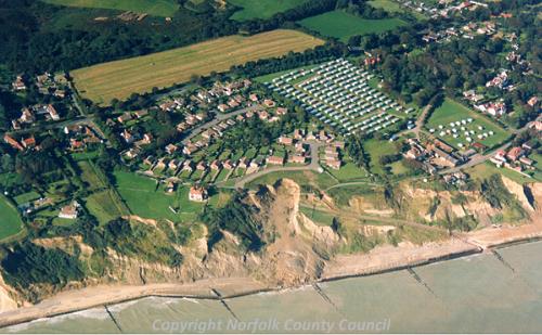
An aerial photograph of Overstrand. (© NCC)
The earliest evidence of human activity comes in the form of Palaeolithic tools. Unfortunately these were all found some time ago, before accurate records were kept, and so the date, location of their discovery and in some cases even the type of tool they were are not specified. Tools (NHER
6461), a bone implement (NHER
6463) and a flint handaxe (NHER
6462) were found in the parish at some time. There are currently no Mesolithic finds, but Neolithic objects include a polished flint axehead (NHER
6466) found in 1897, part of a chipped axehead (NHER
6468) and a fabricator (NHER
14031).
At present there is no sign of Bronze Age, Iron Age or Roman occupation, and the only Saxon Find is a coin (NHER 6467).
The medieval period has left the parish with traces of its oldest surviving building, St Martin’s Church (NHER 6479). This church replaced an earlier one that was washed away in 1399. It was in ruins by the 18th century before being restored between 1911 and 1914. The building consists of an embattled west tower, nave, north aisle, chancel and a south porch that was originally on the north side. In the south wall of the tower is a small oven for baking wafers, its flue coming out near the top. Inside, the roofs are 20th century, as are the aisle and arcade. The old north door has been left in position, and following the addition of the north aisle is now an interesting internal feature. There is a tablet to Sir Thomas Fowell Buxton (who died in 1854), the philanthropist and anti-slavery campaigner.
Post medieval Overstrand is most notable for the impressive buildings that sprang up from the turn of the century to the start of World War One. The coming of the railway (NHER 13585) to north Norfolk made the area popular with holiday visitors, and following newspaper articles, books and poems by Clement Scott, in which he referred to the area as ‘Poppylands’, the interest of the wealthy was aroused, to the extent that Overstrand itself became known as the village of millionaires.
On the cliff, the young Edwin Lutyens was the architect for The Pleasaunce (NHER 6477). Adapted from two existing seaside villas, this is a large and eccentric house, built largely between 1897 and 1899 for the first Lord Battersea. It is very irregular in plan, tile hung, with facades of two and three storeys. Lady Battersea antagonised Lutyens by constantly amending the design, and his wish to demolish the existing villas was overruled, so he was forced to disguise them. His more capricious inventions are therefore confined to the new satellite buildings, notably the curious ranges to the north and south of the house, with an austere white painted clock tower in a stable yard and a drum-shaped former bakery to the north and a detached covered walk to the south. To the west are open octagonal garden houses with high roofs. A public road runs between the stables and the house, and Lutyens provided a curious gateway in the garden wall. An Ionic pilaster and column on either side carry a heavy entablature on which is an exuberant and excessively large coat of arms. The gardens (NHER 30482) are in Arts and Crafts-style, originally covering about 20 hectares, but now reduced to about 2.5 hectares.
Overstrand Hall (NHER 6478), also by Lutyens, was built in 1900 for Lord Hillingdon. It is one of Lutyen’s most remarkable buildings and an example of the completely over-the-top design demanded by the wealthy at the turn of the century. It is a courtyard house of involved plan. Lutyens introduced almost too many contrasts - in materials, stone with half timbering, flint with brick and tile; in style, Jacobean with classical, vernacular with Italianate - but the effect is memorable. For many years a convalescent home, it is now an education and activity centre.
Lutyens also designed the Methodist Chapel (NHER 25395) at the east end of the village. This building was constructed in 1898. Apparently Lord Battersea, who lived at The Pleasaunce (NHER 6477) had it built to keep his gardener happy. Rectangular in plan, the chapel has an east entrance doorway with six orders of semicircular brick arches. The side walls have no windows, the light coming from a high-set clerestory.
Another notable building is Sea Marge (NHER 25396) at the east end of Overstrand in High Street. This large half timbered Edwardian house, now a hotel, was built between 1908 and 1912 by the German born financier Sir Otto Speyer, who was apparently later stripped of his title and deported as a spy. The building is irregular in plan, two and three storeys high with a pebbledashed ground floor to the road façade. A projecting bay window and porch are set in front of a three storey timbered tower under a pyramid roof. At the back are six gabled bays. The interior has oak panelling, a galleried hall with a stone fireplace and a bathroom with contemporary Japanese tiles.
The landscape of the parish changed dramatically during World War Two with the construction of a huge network of anti-invasion structures along the Norfolk coast. These included pillboxes (for example NHER 38507, 38941, 38949, 38947 and 38962), training areas (for example NHER 38512 and 38921), weapons pits (for example NHER 38928), slit trenches (for example NHER 38980) and gun emplacements (for example NHER 38981 and 38982). The massive scale of these defences can be seen on contemporary aerial photographs, and although most of them were dismantled and cleared away after the war, some buildings do remain, like the pillbox at NHER 32568).
Piet Aldridge (NLA), 30 October 2006.
Further Reading
Brown, P. (Ed.), 1984. Domesday Book; Norfolk (Chichester, Phillimore & Co)
Norfolk Federation of Women’s Institutes, 1990. The Norfolk Village Book (Newbury, Countryside Books, and Norwich, N.F.W.I.)
Pevsner, N. and Wilson, B., 1997. The Buildings of England, Second Edition, Norfolk 1 (London, Penguin Books)
Rye, J., 1991. A Popular Guide to Norfolk Place Names (Dereham, The Larks Press)