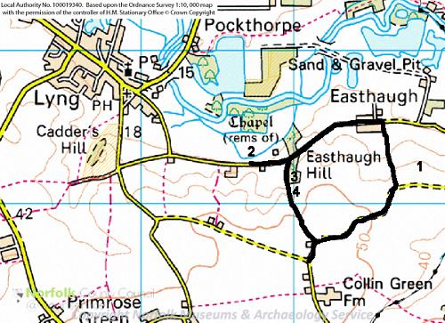
A map of the Lyng Heritage Trail.
Starting point TG 0810 1660. Approximately 2.5/3.0 kms. Some areas can be muddy. One stile. Some easy downhill/uphill walking. Excellent views.
Park near the junction of Collen’s Green and Hase’s Lane, just north of Collin Green Farm, south-east of Lyng village. Walk away from the farm, and continue along the same road, Hase’s Lane, passing a hard standing and some derelict and very overgrown farm buildings on your left. The road goes round a number of bends, with fine views over the Wensum valley to the north.

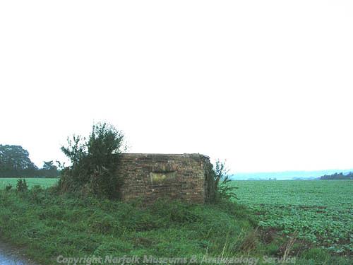
World War Two pillbox, Lyng (© NCC)
1)
World War Two pillbox - NHER
32443A common type 22 hexagonal concrete pillbox, built in about 1940 as part of the anti invasion defences of the time. Aerial photographs taken just after the war show earthworks and buildings around the pillbox that may have been gun emplacements or a searchlight battery.
Retrace your steps for a short distance until you reach a footpath to the right, taking you downhill. Follow this down until you reach the road near Valley Farm. Turn left and walk through the hamlet of Lyng Easthaugh.
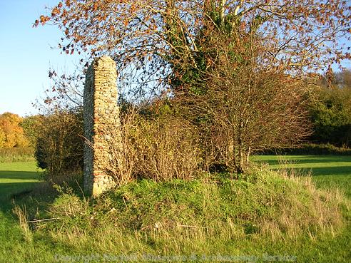
Continue along the road until you spot, in a field to the right, the ruins of St Edmund's chapel.

The ruins of St Edmund's Chapel, Lyng. The fragmentary remains of a probably 15th century priory church. (© NCC)
2)
Ruins of St Edmund’s Chapel - NHER
3048The fragmentary remains of a probably 15th century priory church, partially obscured by vegetation. A broad range of Roman, Saxon, medieval and post medieval objects have been found on the site since the 19th century, but mostly in more recent years by metal detecting. Other finds include a Mesolithic microlith and a very rare Middle Saxon spur.
Retrace your steps for a few yards then turn right over a stile on a footpath.
3) The Grove or King’s Grove - NHER 41344
This is a footpath which starts near the bend at the top of Hase’s Lane, and which runs north from Collen’s (or Collin) Green to Easthaugh Road, down a strip of woodland of contorted oaks and dark hollies called ‘The Grove’. This is an ancient road or track, a ‘hollow way’ running from the high ground down to the floodplain of the River Wensum. It is shown very clearly as such on Faden’s map of 1797, connecting to roads leading to Hockering, Hungate Common and Weston Longville.
An article in the EDP of 13 March 1939 records the fascinating legends attached to this supposedly dark, lonely and mysterious place, and suggests that the name indicates a place where in ancient times secret religious mysteries or magic-working were practised, and which was possessed by ghosts.
In the mid 1800s, local schoolchildren were allowed out of school early, so that they could get past one particular spot before it got dark. And the reason? This was a place where headless horses had been seen! Then there is the story that this is really ‘King’s Grove’, and the site of a long-forgotten battle between St Edmund and the Danes. St Edmund was defeated and retreated to Castle Acre, leaving the bodies of his soldiers strewn along the escarpment they had tried in vain to defend, and whose spirits allegedly haunt The Grove to this day.
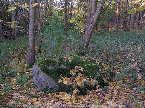
Half way up The Grove beside the path is The Great Stone of Lyng.

The Great Stone of Lyng. Local legend says that it bleeds, that birds cannot be heard singing near it and that treasure is buried beneath it. (© NCC)
4)
The Great Stone of Lyng - NHER
3057A large erratic stone set beside a public foot path. The stone is subject to local legends, including the allegations that it bleeds, that birds cannot be heard singing near it and that treasure is buried beneath it.
Norfolk has no real native rock, but the countryside has a number of 'erratics' or large boulders brought here by the glaciers of the last ice age. These ancient features of the landscape were almost certainly important to our pagan ancestors, who frequently moved them to other spots and venerated them, or used them as way-markers, boundary points, meeting places, court sites or preaching stones. They are often the subject of local legends or superstitions, involving druids, devils, sounds, the stone moving or growing, burials and treasure.
An article in the EDP on 13 March 1939 recounts how the large toad-shaped boulder is the focal point of the ‘dark legend of The Grove’. On certain nights – it doesn’t say which - the stone is said to bleed if pricked with a pin. The blood in the stone was perhaps absorbed after its use as a sacrificial altar, or following the bloody battle between King Edmund and the Danes. A second legend tells of treasure buried beneath the stone, but also how a former owner once tried to move the stone without success!
Other large stones in Norfolk include the Longfield Stone near Dunton and a boulder at Stonebridge, near East Wretham (both once court sites), and The Cowell Stone at the junction of the Icknield Way and Fincham Drove (marking the junction of the parish boundaries of Narborough, Marham, Swaffham and Beechamwell. Herolf’s Stone at Harleston is allegedly named after a Danish chieftain. A stone outside St Mary's church, Bungay is called the Druid's Stone.
Finally, at Sheringham there are two small stones that are said to get up and run across the road when they hear the cockcrow, while a boulder at Caldecote does a sprint at midnight.
Continue up the path until you reach the road near the derelict farm buildings close to the start of the walk.
D. Gurney (NLA), 17 May 2007.