Early histories of Yarmouth claim that Yarmouth was first settled by the Saxon King Cerdicus, around 495 AD in the area of South Town, and an area known as West Town. These settlements were abandoned soon after settlement in favour of a new town on the Cerdic Shore (i.e. where the modern town centre lies) (e.g. Manship, 1854, 12, Nashe, 1985, 387). Palmer discounts these claims, suggesting that Bede confused the names of Gernemuth (Yarmouth) and Cernemuth (Charmouth, Dorset) (Manship, 1854, 212). Bede makes no mention of Cerdic in 495AD. However, the Anglo-Saxon Chronicle states that
"495. In this year two princes, Cerdic and Cynric his son, came to Britain with five ships [arriving] at the place which is called Cerdicesora, and the same day they fought against the Welsh" (Garmonsway, 1984, 14-15)
There is no mention of either Gernemuth or Cernemuth in the Anglo-Saxon Chronicle.
In reality, occupation of the spit probably began as a series of temporary camps used by transient fishermen for net drying and fish preservation, as suggested by Blomefield (1810, p.259).
The Domesday Book records Yarmouth as Gernemwa, and notes that in the reign of Edward the Confessor (1042-1066), the town had 70 burgesses and a church (Brown, 1984, 1,67-68). Hence, Great Yarmouth was one of only three boroughs in the county. Gorleston (Gorlestuna) was listed as containing 20 villeins in the time of Edward the Confessor, dropping to 12 by 1086, along with 5 bordars, 5 slaves and 6 freemen. 24 fishermen were listed as living in Yarmouth but belonging to Gorleston (Williams and Martin, 2002, 1187ff).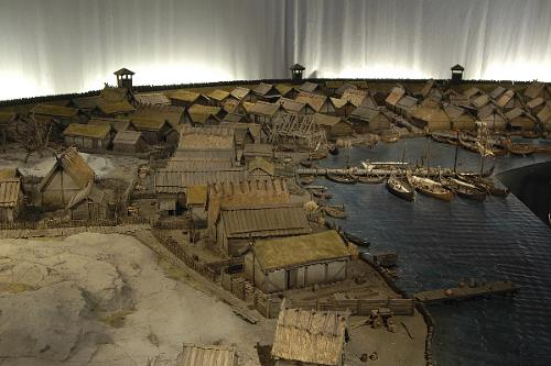
The earliest settlement within the town was probably centred on ground around the Fullers Hill – Church Plain area: the town’s oldest surviving structures (St. Nicholas Church, Row 77 / Howard St undercrofts and the Tolhouse) follow a slight topographic rise running along the western edge of the Market Place. Excavations at (Fullers Hill) uncovered a series of clay floors with associated domestic and industrial waste (mostly connected to fishing). Unfortunately, the excavated area was not large enough to determine the exact nature of the structures uncovered. However, the presence of several layers of Aeolian (windblown) sand in between occupation deposits suggests that early structures were relatively transient in nature, and were frequently rebuilt on the same lines (Rogerson, 1976, 159).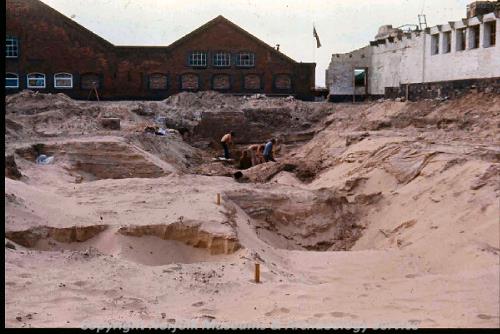
Earliest deposits at Fullers Hill were dated typologically, numismatically and scientifically to the start of the 11th century (Rogerson, 1976, 161, calibrated by GYAM staff).
Excavations by Norfolk Archaeological Unit (now NAU Archaeology) on the former Lacons Brewery site, immediately to the west of Fuller's Hill recovered Saxon and early Medieval pottery from deposits along the Medieval river bank, although the Late Saxon material was present as residual material (i.e. deposited later than the date of the material) (Donald and Shelley, in prep., 2-3).
Click here for the Great Yarmouth bibliography.