1933 to 1973
The Norfolk Historic Environment Record began life as the Norfolk Archaeological Index - a simple list of sites and finds compiled by Roy Rainbird Clarke (1914 -1963) when (probably as an undergraduate at Cambridge in the early 1930s) he became the Norfolk correspondent assisting O.G.S. Crawford, the Ordnance Survey's Archaeological Officer, to collect information on Roman Norfolk for the revision of antiquities on the Ordnance Survey Map of Roman Britain. Early notes on scraps of paper soon progressed to a card index, with information being collected not only on Roman sites and finds, but for the prehistoric, Anglo-Saxon and medieval periods, and with locations recorded on 1:10,560 (6 inch) maps. Clarke brought this index and the maps with him when he joined the staff at Norwich Castle in 1946, and he and his colleagues in the Archaeology Department continued to record discoveries as part of their day-to-day activities. After his death in 1963 the index was given to the Museum and continued by its staff, and supplementary records such as drawings, photographs and notes were placed in 'parish’ or ‘site envelopes'. Records for the city of Norwich were initially kept separate.
1973
A new system of numbering sites in Norwich was set up to meet the needs of the newly-formed Norwich Survey. This enabled material excavated in the City to be integrated into the archive.

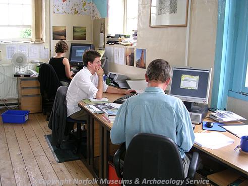
The office of the NHER at Gressenhall Farm and Workhouse. (© NCC)
1974 to 1984When the Norfolk Archaeological Unit was established, a duplicate copy of the index was created at Gressenhall. A new format was adopted based on a single number sequence rather than the parish-based filing system used previously and the archive was renamed the Norfolk Sites and Monuments Record (SMR). The range of information entered was also considerably expanded, in particular to cover important medieval and post medieval buildings. The new system employed only hard copy, and consisted of:
- ‘Primary Record Cards’ containing basic location, period, site and find type information
- ‘Secondary files’ with more detailed information, lists of finds, coin sheets, press cuttings, field notes etc.
- 1:10,560 (6 inch) maps and some cropmark overlays
Searches by parish/period/type were possible using an optical coincidence system. Records for the City of Norwich were maintained in a separate system.
1984 to 1992
The Primary Record Number Cards were computerised (‘Version One’ software and subsequently ‘Superfile’) with funding from English Heritage and the Royal Commission for Historic Monuments of England.
1989
The records for Norwich were integrated with the main SMR (funded by English Heritage), since when the Norfolk SMR has been maintained as a single countywide record.
1991
The Norfolk Archaeological Unit was restructured, and the new ‘curatorial’ section Norfolk Landscape Archaeology took over the management of the SMR.

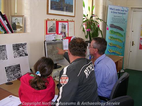
Piet Aldridge (NLA) demonstrating the Norfolk Historic Environment Record to visitors during the History Fair at Gressenhall Farm and Workhouse in May 2006. (© NCC)
1990 to 1992The spatial data on the original 1:10,560 (6 inch) scale maps was transferred to 1:10,000 scale maps. In urban areas, data was remapped at 1:2500 and 1:1250.
1992
The computerised database was transferred to ‘Oracle’ software.
1995
The SMR was audited as part of the first SMR Data Audit for the Royal Commission for Historic Monuments of England.
1995
The SMR was adopted by Norfolk County Council for the purposes of the General Development Order 1995.
1996
A security copy of the entire contents of the secondary paper files was created, involving the copying and filing of more than 87,000 documents. The security copy was tranferred to the NCM.
1998
The SMR was audited as part of the second SMR Data Audit for the Royal Commission for Historic Monuments of England. The SMR database was transferred to exeGesIS HBSMR software.
2000
Separate full time posts of Records Officer and Development Control Officer were established. The Norwich Urban Archaeological Database was transferred to Norfolk Landscape Archaeology.
2001
The Norwich Castle ‘parish envelopes’ were integrated with the SMR.
2002
Spatial data was transferred from film maps to a Geographic Information System (GIS, exeGesIS HBSMR mapping modules and MapInfo) as point data. The SMR was formally adopted by Norfolk County Council. The SMR was renamed as the Norfolk Historic Environment Record (NHER). The NHER offices were reorganised.
2004
The HER was upgraded to HBSMR version 3 software.

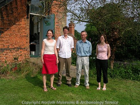
The Norfolk Heritage Explorer team in the first week of the project. (© NCC)
2005The Norwich Urban Archaeological Database was integrated into the HER. The Norfolk Heritage Explorer Project began work to publish the HER on the web.
2006
The GIS mapping was checked against the old film maps. The points were validated and polygons created. Listed Building data was imported creating complete records for all English Heritage protected buildings within the county.
2007
The GIS mapping project was completed. Norfolk County Council's Department of Planning and Transportation records of historic buildings were added to the HER.
On 19 July 2007, The Lord and Lady Walpole officially launched the online version of the Norfolk Historic Environment Record, the Norfolk Heritage Explorer, at http://www.heritage.norfolk.gov.uk
2008
In June 2008, a Search by Postcode facility was added.
In early November 2008, the Norfolk Heritage Explorer had its 20,000th visitor.
On Monday 10th November, the Norfolk Heritage Explorer was a Finalist at the British Archaeological Awards 2008, and was Highly Commended in the Best Archaeological ICT Project category.
2012
In August 2012, the Norfolk Heritage Explorer website had its 100,000th visitor.
The Norfolk Heritage Explorer website was revised and refreshed, with a new look, improved mapping, greatly enhanced content and links to social media.
In October 2012 work commenced on a two-year project to fully integrate records produced for the Norwich Urban Archaeological Database and reviewing and enhancing all Norwich records and mapping.
Records for Norfolk schools and milestones were added.
Data from the former Heritage and Landscape Team, now integrated into the Historic Environment Service, are being integrated.
From October 2012 data on portable antiquities are entered directly onto the Portable Antiquities Scheme database (www.finds.org.uk) and then migrated digitally onto the HER.
2013
The Norfolk HER is awarded an English Heritage grant for an enhancement project focussing on early prehistoric records (for the Palaeolithic and Mesolithic periods).
HER staff (1973 to present)
Mary Karshner, Norwich SMR, 1973
Edwin Rose, Records Officer, 1974 to 2000
Phil Williams, Assistant Records/Computing Officer, 1984 to 1988
Olwen Beazley, Assistant Records (Norwich), 1987 to 1989
Susan Robinson (nee Clarke), Assistant Records/Computing Officer, 1988 to 1990
Joan Daniells, SMR Assistant, 1989 to 2001
Myk Flitcroft, Assistant Records/Computing Officer/consultant, 1990 to 1998
Annette Mills, Records Assistant, 2000 to 2001
Jan Allen, Records Officer then Records Manager, 2000 to 2007
Martin Horlock, Archaeological Records Assistant, 2001 to 2003
Alice Cattermole, Assistant Records Officer 2004, then Historic Environment Record Officer / Senior Historic Environment Officer (Records) 2005 to present
Aly Bowkett, Mapping Assistant, 2005 to 2006
Calyn Keohane, Mapping Assistant 2006 to 2007
Ellen Bales, HER Assistant 2007
Heather Hamilton, Assistant HER Officer, 2007 to 2009, 2012 to present
Hazel White, HER Assistant 2008 to 2010.
Sarah Howard, Assistant Historic Environment Record Officer, 2009 to 2012.
Emma Whitcombe, HER Assistant, 2010 to 2011.
Alison Yardy, Historic Environment Officer (Landscapes) and Acting Senior Historic Environment Officer (Records), 2011 to present
Andrea Beckham, HER Assistant 2011 to present.
Pete Watkins, Assistant Record Officer (Norwich and Palaeolithic and Mesolithic record enhancement projects) 2012 to present.
Jo Yates, Business Support Assistant, 2012
Norfolk Heritage Explorer Project staff 2005 to 2012
David Gurney, Project Manager 2005 to 2007
David Robertson, Records Team Leader, 2005 to 2006
Pieter Aldridge, Records Assistant 2005 to 2006, then Records Team Leader 2006 to 2007
Megan Dennis, Records Assistant 2005 to 2006 then Outreach and Education Officer, 2006 to 2007
Sarah Spooner, Records Assistant, 2005 to 2006
Tom Sunley, Records Assistant 2006 to 2007
Ruth Fillery-Travis, Records Assistant, 2006 to 2007
Richard Hoggett, Community Archaeologist (NHE enhancement project) 2012