The earliest written account of apples in England comes from a 13th century Norfolk document which describes how a Norfolk farmer paid his annual rent with '200 Pearmains and 4 hogsheads of Pearmain cider.' Since this record the farming of apples has thrived for 800 years in Norfolk.
In the 19th century many farmers began to diversify and large commercial orchards were planted. These are particularly common in the heavy clay soils of south and east Norfolk and in the fens. Many large scale orchards can still be seen if you drive from King’s Lynn to Wisbech. The apples from these orchards were often transported out of the county and used for jam making. Other smaller orchards provided fresh fruit locally and apples were also sent to London. Gaymer Cider Works was also a large consumer of local apples.
More recently many of the smaller orchards were destroyed because they were no longer profitable. The urban gardens and orchards that provided fresh fruit and vegetables to the markets of larger towns like Norwich, King’s Lynn and Great Yarmouth were gradually replaced with buildings as it became cheaper to transport fresh foods long distances. Now many of our apples come from France, South Africa, New Zealand and America.
Many of the apples produced in Norfolk in the past were used to make cider. Cider making is recorded in South Norfolk from medieval times. By the beginning of the 19th century it had become an important industry centred around the village of Banham. William Gaymer moved his business from Banham to nearby Attleborough in the late 19th century and it soon became the largest cyder-making factory in the region, relying on many local small holders for apples. The factory closed in 1995 but Gaymers Cyder is still a brand name and is now made in Somerset.
In the last fifty years around 75% of all Norfolk orchards have been grubbed out. The Norfolk Historic Environment Record records the sites of some of these destroyed orchards. We are keen to record more so please let us know about any old orchards that have now been destroyed. Many of these lost orchards are recorded on old maps. The area of the new bus station in Norwich is marked as small orchard plots or gardens on a map made in 1581.
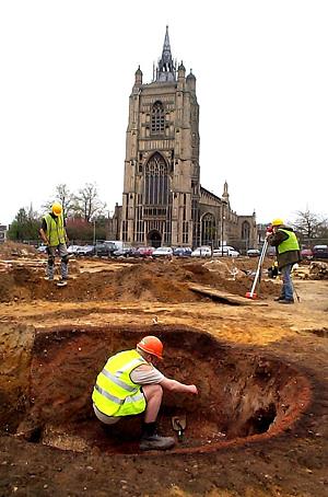
An NAU excavation on the site of the Millenium Library in Norwich in 2001. (© NCC)
Other orchards can be identified by excavation in combination with documentary research. On Bethel Street, Norwich little building seems to have taken place during the 13th and 14th centuries. Documentary and archaeological evidence suggests that most of the area was turned over to gardening and may have been an orchard. The area was probably owned by the Hospital of St Mary in the Fields which was established in 1248.
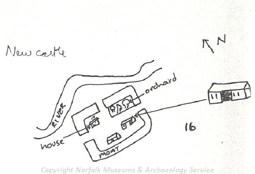
Sketch of a map of Morley Castle. (© NCC)
Orchards were often connected to large and important houses. On a map of Morley Castle (NHER 3008) drawn in the 17th century the house is shown inside the northwest corner of a moat with an orchard inside the northeast corner, and two barns within the south side.
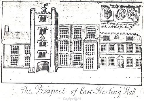
Sketch of East Harling Hall.
Harling Old Hall (NHER 6029) was built around 1490 almost certainly on the site of medieval Herling's Manor. Flint and brick foundations of a post medieval kitchen, garden and orchard walls have been recorded at the site.
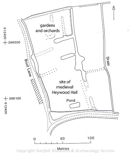
Earthwork plan of Heywood Hall, Diss. (© NCC)
Within the complex earthworks of a medieval moated site at Heywood Hall (NHER 10941) are the remains of the medieval hall and a series of linear earthwork features which may have divided the enclosure up into gardens, orchards and fishponds.
The gardens of Stiffkey Park (NHER 30488) were originally laid out in 1590. The orchard to the south was used as a wilderness in 1597 with paths cut through it, only traces now remain.
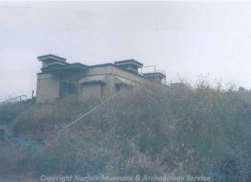
The Royal Observers Corp headquarters at Sprowston, Norwich, built in an orchard. (© NCC)
During the post medieval period many of Norfolk’s orchards started to go into disuse. At one orchard in Norwich a World War Two bunker was built. This was partially disguised by the trees all around it. The bunker was used by the radar controllers for RAF Coltishall. Later in the 1950s the Royal Observer Corps built a headquarters (NHER 26488) on the same site.
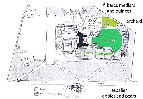
Plan of the Arts and Crafts garden at Voewood including an orchard area.
Some modern garden designers incorporated orchards into their garden designs. Voewood Gardens (NHER 37581), a formal sunken garden, kitchen garden and orchard, was designed as an ensemble in 1905. The gardens surrounded Voewood (NHER 6489), an Arts and Crafts butterfly-plan house, by Edward S. Prior.
With the recent interest in local foods there has been renewed enthusiasm for Norfolk apple varieties. This is celebrated at a series of Apple Days throughout the region. This article has been developed from a presentation originally displayed at Apple Day 2006 at Gressenhall Farm and Workhouse. The day was organised in collaboration with East of England Apples and Orchards Project who are currently surveying surviving orchards in the east of England. With increasing interest in local and regional varieties it seems that the orchards of Norfolk have a healthy future.
M. Dennis (NLA), 21 December 2006.
Further Reading
EEAOP, 2007. ‘EEAOP – East of England Apples and Orchards project’. Available:
http://www.applesandorchards.org.uk, Accessed 21 December 2006.