The starting point and car park for this walk is the Gressenhall Farm and Workhouse. Most of the archaeological sites mentioned in the text are on private land, and are not accessible to the public unless mentioned in the text.

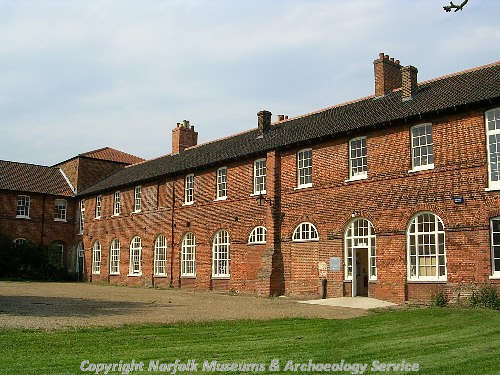
The 18th century former workhouse in Gressenhall. This wing is now the offices of Norfolk Historic Environment Service. (© NCC)
1. Gressenhall Farm and Workhouse - NHER
2819The workhouse was built in 1777, one of the earliest 'Houses of Industry' in Norfolk. The main block and the east wing date from the 18th century, whilst the chapel, boundary wall and other buildings within the complex date from the 19th century. The building was in use as a workhouse until 1948, when it became an old people's home. The building is now the Gressenhall Farm and Workhouse and the offices of Norfolk Landscape Archaeology.

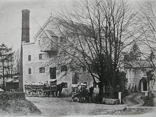
The 19th century water mill before it was burnt down in 1914.
2. Miller's house and site of medieval watermill – NHER 12758
This is the site of a substantial watermill, which probably dated to the 19th century, and which stood on the site of a medieval watermill. The mill burnt down in 1914 and was demolished. The miller's house has survived, and contains reused panelling. Various querns and millstones have been found in the garden.
3. World War Two aircraft crash site – NHER 12801
The crash site of an American World War Two Liberator aircraft.
4. Dillington Hall, Dereham – NHER 2887
This red brick Georgian house has five bays and three storeys. The central bays project slightly and contain a Classical doorcase. The house is H shaped and was built in 1795 by Daniels of Lexham. The extensive farm buildings have now been converted into houses.
5. Site of possible Bronze Age ring ditch and trackway – NHER 18817
A ring ditch and a trackway are visible as cropmarks on aerial photographs. The ring ditch may be the remains of a Bronze Age barrow.
6. Site of World War Two gun emplacement – NHER 33782
A World War Two gun emplacement is visible on aerial photographs taken in March 1946. It was probably associated with a pillbox (NHER 14242) that was located close by.
7. World War Two pillbox – NHER 14242
A surviving World War Two pillbox stands beside the railway. It was probably associated with a gun emplacement (NHER 33782) that was located close by.
8. Site of probable Bronze Age barrow – NHER 2789
It is reported that a barrow, probably Bronze Age in date, was destroyed around 1845 and that several urns were collected from it. The exact site of the barrow is uncertain, although as a railway was constructed here around 1845 this could be it.
9. World War Two practice trenches and butts on Hoe Common – NHER 30929
World War Two practice trenches and butts survive as earthworks on Hoe Common. They are also visible on 1940s aerial photographs.
Oscar Paterson (Litcham High School), 22 June 2006.