This Parish Summary is an overview of the large amount of information held for the parish, and only selected examples of sites and finds in each period are given. It has been beyond the scope of the project to carry out detailed research into the historical background, documents, maps or other sources, but we hope that the Parish Summaries will encourage users to refer to the detailed records, and to consult the bibliographical sources referred to below. Feedback and any corrections are welcomed by email to heritage@norfolk.gov.uk
Barford is a small parish located west of the city of Norwich and sandwiched between Barnham Broom to the west and Great Melton and Wramplingham to the east. Its name comes from the Old English for ‘Barley ford’, a ford used at harvest time. In the Domesday Book the area is recorded as being owned by Count Alan, Richard and St Benedict of Holme ‘for the supplies of monks’. Prior to the Conquest, the land had been owned by Gyrth and Stigand, who were probably Saxons.
The archaeological record suggests there was human activity in the parish from the earliest times. Prehistoric finds include a Palaeolithic flint core and Neolithic flint axes, scrapers, flakes and blades. Also found have been burnt mounds, prehistoric collections of burnt stone that were probably heated in fires and used to warm food or liquids. There does not appear to be any evidence for Bronze Age habitation, although some of the flint finds in the area have only been given the general classification of prehistoric, and may date to this period. Likewise, evidence of activity in the Iron Age is confined to a single coin.
The parish has been extensively fieldwalked and surveyed by metal detector. These activities have yielded Roman coins and pottery as evidence of the Roman occupation and Saxon brooches and pottery as evidence of continuing habitation.

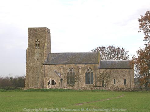
St Botolph's Church, Barford. (©NCC)
These surveys have also turned up pottery, coins and a brooch from the medieval period. However, the only medieval building to survive is St Botolph’s Church (NHER 9282), which has a 13th century nave (possibly even earlier) and a 14th century tower. A medieval cross is mentioned in old texts (NHER 12240) but nothing remains today.

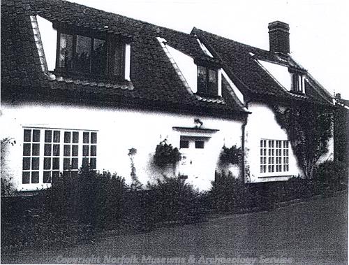
Swallow Cottage, an 18th century cottage with a 19th century extension in Barford. (©NCC)
The archaeological record remains quiet in the post medieval period, with pottery fragments recovered, together with a buckle and a coin. Buildings from the period include Dalstrand (NHER
40333), a 17th century and later cottage of brick over a timber frame, and School Farm (NHER
37016) which dates to 1694. Swallow Cottage (NHER
40332) is 18th century with a 19th century extension.
Generally, the NHER records reflect the rural and agricultural nature of the parish. It has been inhabited over a long period of time, with people having left mainly fragmentary evidence of occupation.
Piet Aldridge (NLA), November 2005.
Further Reading
Brown, P. (ed.), 1984. Domesday Book: Norfolk (Chichester, Phillimore)
Mills, A.D., 1998. Dictionary of English Place-Names (Oxford, Oxford University Press)
Rye, J., 1991. A Popular Guide to Norfolk Place-names (Dereham, Larks Press)