This Parish Summary is an overview of the large amount of information held for the parish, and only selected examples of sites and finds in each period are given. It has been beyond the scope of the project to carry out detailed research into the historical background, documents, maps or other sources, but we hope that the Parish Summaries will encourage users to refer to the detailed records, and to consult the bibliographical sources referred to below. Feedback and any corrections are welcomed by email to heritage@norfolk.gov.uk
Honing is a fairly large parish in northeast Norfolk, to the east of North Walsham. Its name comes from the Old English for something approaching ‘settlement of the people at the hill or rock’. The parish has a long history, and was certainly well established by the time of the Norman Conquest, its population, land ownership and productive resources being detailed in the Domesday Book of 1086.
Evidence of human activity until the medieval period and beyond is currently quite sparse. The earliest objects found so far are a Mesolithic or possibly Neolithic flint axehead (NHER 33133) and a Neolithic chipped axehead that turned up on a potato harvester in 1976 (NHER 12309). The Bronze Age may have left fragmentary traces of the earliest structures in the parish. Aerial photography has noted the cropmarks of one or possibly two ring ditches (NHER 31745 and 36755). These are the surrounding ditches of circular burial mounds that have since been flattened by farming, invisible from the ground. The only Bronze Age find to date is a copper alloy palstave (NHER 16964). As yet there is no evidence of Iron Age activity, and Roman evidence is confined to a single piece of pottery (NHER 31547) found in an otherwise undated enclosure cropmark north of Station Road. There are currently no Saxon finds.
The medieval period has left the parish with its oldest surviving buildings, All Saints’ Church in Crostwight (NHER 8204) to the north and the Church of St Peter and St Paul, Honing (NHER 8205), to the south. Of the two, All Saints' is the older. Set in fields and isolated, the nearest building being its former rectory, this parish church consists of a west tower, pantiled nave, thatched chancel and south porch. The main body of the church is largely 14th century, though parts of the chancel show signs of an earlier origin. The south porch is 15th century. The windows are all later replacements, the east one being from a restoration of 1896, when the roofs were renewed. The big west tower had its upper part taken down and its belfry lowered in 1910, after ivy had made it unsafe, the stump being capped with a tiled pyramid roof, recently renewed. The square south porch is appealing, with its rough rural outer arch topped with two tiny (empty) figure niches. A holy water stoup in the porch has had a drain added to make it a piscina, possibly indicating that there was once a porch altar here.
Inside, the light and airy nave has simple modern furnishings, but the original 13th century octagonal font survives, though much restored. Parts of the 15th century screen also survive, though much of it is probably a later replacement. The most striking internal feature, however, is a series of fine late 14th century wall paintings on the north nave wall, one of the most extensive in East Anglia. These represent the Passion sequence (i.e. the entrance of Christ into Jerusalem through to the Crucifixion, Resurrection and Ascension into Heaven). On either side of the altar in the simple chancel is a heavy re-set 13th century coffin slab. The church has several memorials, including one dated 1604 on the north chancel wall and a relatively grand one for the only man in the parish killed in World War Two, who was lost when The Royal Oak was sunk at Scapa Flow in 1939.
The well-kept churchyard has a number of interesting gravestones. A large-bramble covered heap to the north of the nave is the rubble from the removed upper stage of the tower.
St Peter and St Paul in Honing is a rather interestingly proportioned church, consisting of a tall west tower, narrowly aisled nave, south porch and a tiny chancel. Originally 15th century, it was almost entirely rebuilt in 1795, when the chancel was constructed to its current size and the nave aisles narrowed. The tower remained as it was, but its west door was partly blocked and rather clumsily converted to a window. These alterations give the interior of the church a slightly strange perspective, as the aisle arcades remain but the aisles themselves form only narrow passageways. A 13th century font survives, and there are a number of interesting floor slabs, mostly hidden under carpets. On each side of the chancel arch is a wall tablet to members of the Cubitt family, and there is also a World War One memorial to members of this family who were lost.
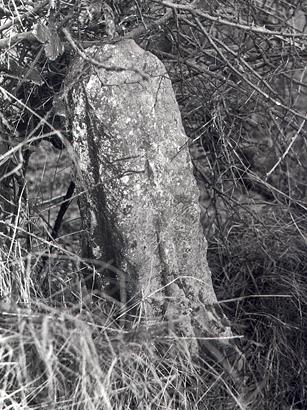
Honing Cross, a fragment of a 15th century stone cross. (© NCC.)
Two medieval stone crosses are recorded in the parish. Part of one (NHER 8196) is still visible in the west of the parish; the other (NHER 6909), to the south of the Happisburgh Road, has not been seen since 1934, but may be covered in undergrowth. Another feature to survive is a late medieval moated site (NHER 8198) in the grounds of Honing Hall (see below). This originally consisted of a rectangular area of ditches fed by a stream, and seems to have been later incorporated into an 18th century designed landscape. Today the site is covered in trees, though the ditches are still partly filled with water.
Two post medieval halls survive, Crostwight Hall (NHER 8201) and Honing Hall (NHER 8200). Of the two, Crostwight is the earlier, originally a mid 16th century flint and brick hall, re-using quantities of medieval ecclesiastical stone. The main building was roughly E shaped, with later west and east extensions, and a two storey central porch with an arched doorway. Robert Walpole acquired the hall in 1720, but the main building was probably in ruins by the end of the 18th century, New Hall to the east having been converted from a service building. The ruinous old hall and its outbuildings (including a large barn, New Hall and a brewhouse) have all now been restored and converted to residential use.
Honing Hall (NHER 8200), the home of the Cubitt family, is a red brick country house of 1748, two and a half storeys high with a black glazed pantile roof. Each side of the main hall building has five window bays, all with sash windows with a later bowed extension to the west. The south front has a decorated gable and an Ionic style doorway with pilasters supporting a plain entablature. Some alterations were carried out in about 1790, including the west bowed extension and the addition of the drawing room fireplace. Humphry Repton designed the hall's park (NHER 29496) in 1792, and also added the flat horizontal mouldings between the storeys. To the north are service wings of about 1868 and a separate Gothic style stable block with a clock and a date of 1884.
Other surviving buildings reflect the strongly agricultural nature of the area, and are mostly farmhouses and farm buildings. Probably the oldest of these is Bush Farmhouse (NHER 21023), a flint and brick thatched farmhouse and attached barn, dating to the 16th century with later alterations, and now converted to a single dwelling. A post medieval pewter dish was found under the floor of the pantry in 1984.
Hall Farm (NHER 17020) is a mid 17th century two storey red brick farmhouse with later alterations. It is T shaped, with Dutch gables and a black glazed pantile roof. A long red brick barn stands nearby. Canal Farm House (NHER 22858) is an early 18th century two storey thatched farmhouse with a patterned brick front and irregularly spaced later windows. The interior has some original wood beams but much has been replaced. Finally, Corner Common Farm (NHER 22891) is an early 18th century two storey thatched brick and flint farmhouse with later alterations and several blocked windows. Inside are some original wooden beams.
To the west of the parish is Briggate Mill (NHER 8206), the burnt-out remains of a 19th century three storey brick watermill on the North Walsham and Dilham canal, probably on the site of an earlier mill. Two steam engines were later housed in a separate corrugated iron building, and the mill was eventually powered by electricity. Closed down in the late 1960s, the mill was gutted by fire in 1975 and has not been restored or redeveloped.
To the north of Crostwight Hall stand the remains of a post medieval building of uncertain function (NHER 16419), its ruins standing about a metre high. At its southwest corner is part of an octagonal tower with an adjoining fireplace. The building is something of a mystery; local legend has it as a church or mill, but it is probably neither of these. Also it is not marked on late 18th, 19th or early 20th century maps.
The Reed House (NHER 43901) is an early 19th century circular garden building in the grounds of Honing Hall with a conical Norfolk reed roof. It has a wide entrance and from the benches inside there is a view of Honing Church. It was built as part of Repton's scheme for the hall grounds.
A railway ran through the parish, part of a line that linked Great Yarmouth to Sutton Bridge via Stalham, North Walsham, Aylsham, Melton Constable, Fakenham and King's Lynn. It opened in stages between 1865 and 1933. A railway bridge (NHER 16713) was constructed in 1881 to take the Dilham Road over the line, and a station (NHER 60561) was opened in Honing in 1882. Honing station closed in 1959 and all of the railway line it served is now closed. However some sections survive as Weaver's Way footpath and the remains of Honing Station including platforms, building foundations, and cattle pens can be viewed from the Weaver's Way footpath.
Other buildings have not survived, their former existence known only from maps. A windmill (NHER 15436), a brick kiln (NHER 15437) and a watermill (NHER 15439) are all marked on 18th century maps, but no trace of them remains today. A 19th century windmill known as Black Mill (NHER 15894) in the east of the parish has similarly disappeared.
The location of the parish near the River Ant and the North Walsham and Dilham canal meant that it was included in a series of World War Two defensive stop lines erected in 1940 when a German incursion along the east coast was considered a possibility. The river and canal formed a natural defence line and this was beefed up at the time by the addition of concrete pillboxes, anti tank emplacements, tank traps and barbed wire. Most of these defences have long gone, but three pillboxes (NHER 21553 17021 and 32561) have survived, together with a tank obstacle on the east side of a viaduct, now a footpath (NHER 39999).
The relative scarcity of finds from the earlier periods of the parish’s existence may just indicate a lack of detailed investigation, and the picture could greatly change in future. It is hard to imagine prime land like this not being extensively utilised by man since the earliest times.
Piet Aldridge (NLA), 30 May 2006.
Further Reading
Brown, P., (ed.), 1984. Domesday Book, 33 Norfolk (Chichester, Phillimore & Co)
Knott, S., 2005. 'All Saints', Crostwight'. Available:
http://www.norfolkchurches.co.uk/crosswight/crosswight.htm. Accessed: 30 May 2006.
Knott, S., 2005. 'St Peter and St Paul, Honing'. Available:
http://www.norfolkchurches.co.uk/honing/honing.htm. Accessed: 30 May 2006.
Rye, J., 1991. A Popular Guide to Norfolk Place Names (Dereham, The Larks Press)