This Parish Summary is an overview of the large amount of information held for the parish, and only selected examples of sites and finds in each period are given. It has been beyond the scope of the project to carry out detailed research into the historical background, documents, maps or other sources, but we hope that the Parish Summaries will encourage users to refer to the detailed records, and to consult the bibliographical sources referred to below. Feedback and any corrections are welcomed by email to heritage@norfolk.gov.uk
Hockering is a small parish in central Norfolk. The small village of Hockering is next to the A47 in the south of the parish, close to the River Tud. Hockering comes from the Old English meaning ‘settlement of the people at the rounded hill’.
Prehistoric flint flakes (NHER 36541 and 40863), a Neolithic flint implement (NHER 7299) and a Neolithic polished axehead (NHER 34933) have been found, as well as a Bronze Age palstave (NHER 25795) found during potato picking in 1990, a Bronze Age socketed axehead and part of a sword (NHER 36541).
Fragments of Iron Age pottery (NHER 30679) have been found close to the River Tud. An early example of an Iron Age hinged brooch (NHER 31058) was found by a metal detectorist. Roman pottery (NHER 28375 and 30679), Roman coins and brooches (NHER 29842, 30679, 36541 and 40863) including a brooch in the shape of a stag (NHER 34934) have also been found.

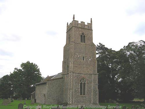
St Michael's Church, Hockering. (© NCC.)
Fieldwalking and metal detecting have also recovered Early Saxon brooches and pottery (NHER
30679), a Middle or Late Saxon strap end (NHER
36541) and Late Saxon pottery (NHER
28375). In the Domesday Book Hockering is recorded as a valuable holding, held by Ralph of Beaufour. The holding included mills, meadows and enough woodland to support two hundred pigs.
St Michael’s Church (NHER 7311) dates from the 13th to the 15th centuries, and was restored in the 19th century. The church contains a 15th century octagonal font with carved figures around the stem.

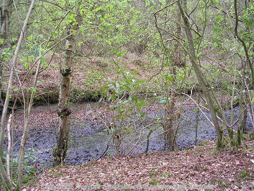
A World War Two bomb bay within Hockering Wood. (© NCC.)
Hockering Wood (NHER
38190) is a large ancient wood that contains the earthworks of a medieval moat (NHER
7307) with traces of an outer enclosure. Medieval brick and flint walls have been found within the moat, which was probably associated with the management of the wood during the medieval period. Other medieval and post medieval earthwork banks are visible within the wood. The outline of a possible medieval deer park (NHER
7309) can be traced in curving field boundaries around Park Farm. A possible medieval moat (NHER
13038) is visible as a cropmark on aerial photographs within the area of the park, as well as another cropmark enclosure of unknown date (NHER
31517). Medieval and post medieval pottery (NHER
14914,
14915,
14916 and
36541) and metal finds (NHER
29842,
42813) have been recovered from the parish.

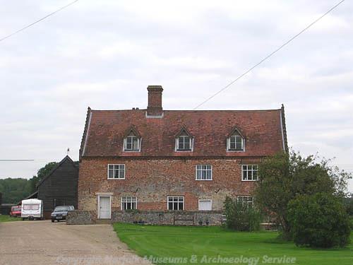
Hockering Manor House. (© NCC.)
Vine Lodge (NHER
17376) is a timber framed building reputed to date back to the early 16th century. The house was formerly used as an inn, and has a 19th century brick façade. The Manor House (NHER
13154) is a 17th century house with crow-stepped gables. The nearby Manor Farm (NHER
13154) is a 17th and 18th century thatched and timber framed barn that has been converted into a house. Yewtree Farmhouse (NHER
13153) is a late 17th or early 18th century house and Overgate Farm (NHER
13152) dates to the 18th century. Both of the houses are decorated with chequered brickwork. Hockering Lodge (NHER
13155) is an early 19th century Gothick style cottage on the edge of Hockering Wood. A tower mill is shown off Heath Road (NHER
7310) on the tithe map of 1838. The mill was demolished in 1960.

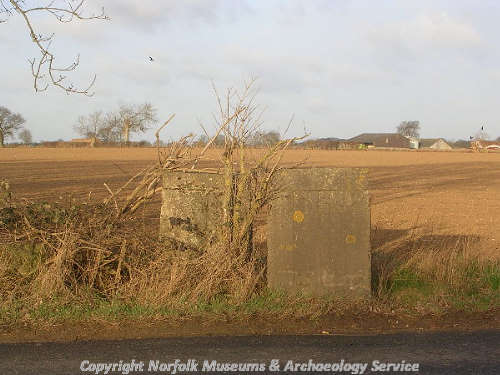
World War Two anti-tank cubes on Attlebridge Airfield. (© NCC.)
During World War Two Hockering Wood (NHER
38190) was used by the RAF as an ammunitions dump, and the wood contains concrete roads, buildings, bomb stores and water tanks. A concrete World War Two building (NHER
41910) stands at the entrance to the wood. The building may have been a sentry post.

A World War Two Nissen hut at the edge of Hockering Wood. (© NCC.)
The remains of a large World War Two airfield (NHER
3063) are in the east of the parish. The airfield is known as Attlebridge Airfield, even though the it does not lie in that parish. The remains include road blocks (NHER
40732) and a pump house (NHER
41968). The airfields administrative offices and headquarters were at Pond Farm (NHER
40763).
Sarah Spooner (NLA), 4 April 2006.
Further Reading
Brown, P. (ed.), 1984. Domesday Book: Norfolk (Chichester, Phillimore)
Mills, A.D., 1998. Dictionary of English Place-Names (Oxford, Oxford University Press)
Rye, J., 1991. A Popular Guide to Norfolk Place-names (Dereham, Larks Press)