This Parish Summary is an overview of the large amount of information held for the parish, and only selected examples of sites and finds in each period are given. It has been beyond the scope of the project to carry out detailed research into the historical background, documents, maps or other sources, but we hope that the Parish Summaries will encourage users to refer to the detailed records, and to consult the bibliographical sources referred to below. Feedback and any corrections are welcomed by email to heritage@norfolk.gov.uk
The parish of Griston is located in Breckland, directly southeast of Watton and northwest of Attleborough. The village is situated in the centre of the parish. Wayland Prison is sited to the west of the village and the former Watton Airfield and military base occupy much of the northern part of the parish.
Almost no archaeological work has been conducted in the parish. A number of site visits have taken place, but there are only three recorded metal detecting finds and only one stray find. No fieldwalking or excavation has taken place.
The earliest object recorded from the parish is an Iron Age coin (NHER 22369). This was probably minted by the Trinovantian tribe who were based in and around modern Essex. It was unearthed when a juniper bush was being planted in the village. A Roman cosmetic pestle, a probable Early Saxon girdle hanger and a Late Saxon stirrup strap mount have been discovered by metal detectorists in the west of the parish.
Griston is recorded as ‘Gristuna’ in the Domesday Book of 1086. This could have several meanings. It may be an Old English name meaning ‘grassy or gravelly enclosure or settlement’ or an Old Norse and Old English hybrid name meaning ‘Griss or Gyrdh’s settlement’. Another possibility is that it could mean ‘the enclosure or farmstead where young pigs are reared’. In 1086 land in Griston parish was held by King William I, William of Warenne, Roger Bigot, Ralph Baynard and John nephew of Waleran. A church, slaves, ploughs, meadows, woodland, pigs, sheep, cattle, horses and ten beehives were recorded.

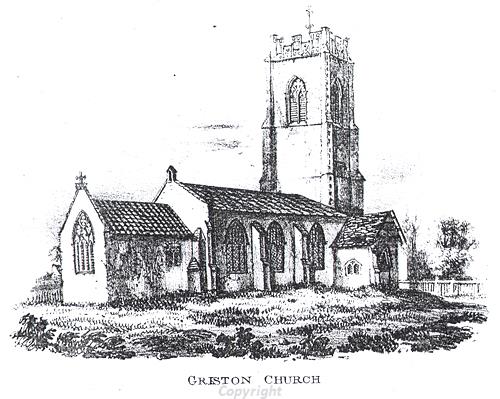
SS Peter and Paul's Church, Griston, a medieval and post medieval church.
The church recorded in the Domesday Book may have stood on the site of the church of SS Peter and St Paul (NHER
8957). Unfortunately no Norman period architecture is visible in the present church. It was built in the early 14th century and restored and partly rebuilt in the late 15th century, 1679 and 1884.
A moat (NHER 8953) at Park Farm could be medieval. If so it is probable that a medieval house would have stood on the platform contained within it. Alternatively, the moat might be a post medieval ornamental feature associated with a post medieval house at Park Farm. The existing house (NHER 19897) is largely 18th and 19th century, although it does include 16th century features. An early 18th century barn stands close by.
Griston Hall (NHER 8954) may have been built on a medieval moated site. It is a late 16th century building with many later features. The associated farm buildings range from 17th to 19th century in date. The story of ‘Babes in the Wood’ has been linked with the nearby Wayland Wood (in Watton parish) and it has been suggested that the ‘wicked uncle’ lived in Griston Hall.
The Old Thatch (NHER 37464) is located in Griston village. It is a late 17th or early 18th century timber framed cottage with a thatched roof. Faden’s map of 1797 shows that in the late 18th century sections of Caston and Griston Common were located in the south of the parish. This common joined with Carbrooke Common in the north and east of the parish.
Watton Airfield was used both by the United States Army Air Force and the RAF during World War Two. It is possible that Allied spies flew from here and parachuted into Germany. After World War Two the station was used as a Radio Warfare Establishment and surface to air missiles aimed at Russia were based here. The airfield closed in 1989 and since then sections of the base in both Watton and Griston parishes have been sold and houses have been built. Many of the military houses have also been sold.
David Robertson, 20 January 2006.
Further Reading
Barringer, C., 1989. Faden’s Map of Norfolk (Dereham, Larks Press)
Brown, P. (ed.), 1984. Domesday Book: Norfolk (Chichester, Phillimore)
Cotton, S., no date. SS Peter and Paul, Griston (Griston, Norfolk Churches Trust)
Mills, A.D., 1998. Dictionary of English Place-Names (Oxford, Oxford University Press)
Rye, J., 1991. A Popular Guide to Norfolk Place-names (Dereham, Larks Press)
Wayland Partnership, unknown. 'Babes In The Wood: Griston Hall, The Wicked Uncle's House'. Available:
http://www.wayland.org.uk/site/wartimewayland/babesinthewood/babesv2. Accessed: 20 January 2006.