This parish summary provides an overview of the large amount of information which we hold about the parish, and only a representative sample of sites and artefacts from each period are mentioned. If you have any feedback on this article please contact us using the link on the left-hand menu or by emailing heritage@norfolk.gov.uk
Alburgh is a small parish in south Norfolk on the boundary with Suffolk. The area is rich in archaeological finds, although there are relatively few recorded sites. The village name means 'old mound or hill' or 'mound or hill belonging to Alda' and the settlement developed into a linear village with buildings lining the road.
The earliest evidence for occupation in the parish dates to the Mesolithic (NHER 24249). A small Neolithic flint knife (NHER 24536) was recovered during fieldwalking in the southwest of the parish and other scatters of prehistoric worked flint and pottery have also been recorded.
There are reports of a Bronze Age barrow (NHER 11043) in the village below or near the church. This monument may be the reason for the village’s name. It was excavated in the 19th century when it was reported that human bones were removed from the barrow. Iron Age pottery (NHER 28625) and an Iron Age silver coin (NHER 30398) are the only finds dating to the end of the prehistoric period.
There are similarly few Roman remains. Roman pottery is recorded in four places in the parish but there is no evidence for buildings or settlements.
There is little evidence for Saxon occupation in the parish, although the eleven or more human skeletons and a large cleaver (NHER 11041) recovered during building works at the New Station House in the south of the parish may date to the Early Saxon period.

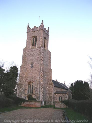
All Saints' Church, Alburgh (©NCC)
The area is particularly rich in medieval sites. The Holbrook Hall medieval moated manor house (NHER 11064) was demolished when nearby Gawdy Hall (NHER 10777) was built in 1570. All that now remains are earthworks of the moat and the building. Similar earthworks can be seen northwest of abbey farm where rectangular enclosures (NHER 11056) surrounded areas of settlement. Medieval pottery has also been recovered from across the parish. The church (NHER 11065) is medieval in date and contains a 14th century painted screen that was restored in 1988.
The earliest standing buildings in the village are Church Farm (NHER 22431) that dates back to the 16th century, and Alburgh Hall (NHER 19462) dated to 1597. The former may have been a hall house. There are extensive 17th century remains including Tudor House (NHER 19463, where painted marks were made on the timber frame to ward off evil), and Threeways Cottage (NHER 14137). There are also several good examples of 18th and 19th century architecture.
The post medieval period saw massive change in the organisation of agriculture when the area was enclosed between 1801 and 1803. Although these changes were far reaching we still see settlement being organised in small groups of rectangular building plots (NHER 11042), as at the site south of Church Farm where post medieval pottery was found on the surface of the field. The site of a post medieval windmill (NHER 15984) has also been recorded, although the mill was destroyed in 1911.

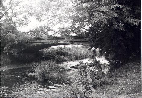
Homersfield Bridge, Alburgh and Redenhall, built in 1869 (©NCC)
The railway arrived in the 19th century. The line is now closed but Homersfield Station can still be seen in the south of the parish. The 19th century also saw the building of the unique Homersfield Bridge (NHER 24371). This 1869 precast concrete and cast iron structure with wrought iron parapet and decorative features includes a coat of arms of the local Adair family of Flixton Hall. This is the earliest bridge of its kind in the country. Confusingly a burial mound (NHER 12203) at Quaker’s Farm is post medieval – the owners of the farm were buried here sometime prior to the 1950s.
Megan Dennis (NLA), 28 July 2005.
Further Reading
Miles, A.D., 1998. Dictionary of English Place Names (Oxford: Oxford University Press)